En
Log in
All resources
Create a design
Tools
7,170 Free Images of Atlas Map
gemeente atlas van nederland - north holland
1860s maps of north holland
copper engraving print
british library
joan blaeu
atlas maior, vol 3 (germany) - joan blaeu, 1667 - bl 114.h(star).3
catalan atlas, 1959 reproduction
gemeente atlas van nederland - south holland
1860s maps of south holland
atlas maior, vol 4 (netherlands) - joan blaeu, 1667 - bl 114.h(star).4
atlas maior, vol 4 (netherlands) - joan blaeu, 1667 - bl 114.h(star).4
1667 maps
atlas maior, vol 3 (germany) - joan blaeu, 1667 - bl 114.h(star).3
old maps of upper austria
atlas maior, vol 8 (france ii and switzerland) - joan blaeu, 1667 - bl 114.h(star).8
1667 maps
atlas maior, vol 3 (germany) - joan blaeu, 1667 - bl 114.h(star).3
copper engraving print
atlas maior, vol 3 (germany) - joan blaeu, 1667 - bl 114.h(star).3
copper engraving print
atlas maior, vol 3 (germany) - joan blaeu, 1667 - bl 114.h(star).3
copper engraving print
atlas maior, vol 3 (germany) - joan blaeu, 1667 - bl 114.h(star).3
copper engraving print
atlas maior, vol 3 (germany) - joan blaeu, 1667 - bl 114.h(star).3
copper engraving print
atlas maior, vol 3 (germany) - joan blaeu, 1667 - bl 114.h(star).3
copper engraving print
atlas maior, vol 3 (germany) - joan blaeu, 1667 - bl 114.h(star).3
copper engraving print
atlas maior, vol 4 (netherlands) - joan blaeu, 1667 - bl 114.h(star).4
copper engraving print
atlas maior, vol 4 (netherlands) - joan blaeu, 1667 - bl 114.h(star).4
copper engraving print
old maps of gelderland
atlas van loon
catalan atlas, 1959 reproduction
maps in the library of congress
1713 maps
gemeente atlas van nederland - north holland
old maps of alkmaar
maps of bergen op zoom by braun & hogenberg
atlas beudeker
maps of wallachia by gerardus mercator
atlas novus (blaeu)
topographischer atlas der schweiz
maps of lake lugano
catalan atlas, 1959 reproduction
catalan atlas, 1959 reproduction
atlas maior, vol 3 (germany) - joan blaeu, 1667 - bl 114.h(star).3
copper engraving print
atlas maior, vol 3 (germany) - joan blaeu, 1667 - bl 114.h(star).3
copper engraving print
atlas maior, vol 3 (germany) - joan blaeu, 1667 - bl 114.h(star).3
copper engraving print
atlas maior, vol 3 (germany) - joan blaeu, 1667 - bl 114.h(star).3
copper engraving print
atlas maior, vol 4 (netherlands) - joan blaeu, 1667 - bl 114.h(star).4
copper engraving print
atlas maior, vol 4 (netherlands) - joan blaeu, 1667 - bl 114.h(star).4
copper engraving print
atlas maior, vol 3 (germany) - joan blaeu, 1667 - bl 114.h(star).3
copper engraving print
atlas maior, vol 3 (germany) - joan blaeu, 1667 - bl 114.h(star).3
copper engraving print
maps of the history of sweden
old maps of scandinavia
catalan atlas, 1959 reproduction
catalan atlas, 1959 reproduction
maps of utrecht (city) city walls
old maps of utrecht (city)
gemeente atlas van nederland - utrecht
maps of oudewater
le neptune francois
1700 maps of cuba
1370s maps of spain
catalan atlas
david rumsey historical map collection
1790s maps of the holy roman empire
maps by christian sgrothen
kaster (germany)
1375 maps of iran
catalan atlas
topographischer atlas der schweiz
weiach
atlas minor gerardi mercatoris (1609)
maps of asia by mercator-hondius
1800s maps of egypt
maps by john cary
travel
maps
maps of goa by braun & hogenberg
old goa
gemeente atlas van nederland - north brabant
andel, netherlands
topographischer atlas der schweiz
old maps of zürich
maps of 's-hertogenbosch by braun & hogenberg
atlas beudeker
gemeente atlas van nederland - groningen
maps of slochteren
old maps of geraardsbergen
atlas van loon
19th-century maps of nièvre
1852 maps of france
maps of made, north brabant
maps of drimmelen
1700s maps of the world
le neptune francois
gemeente atlas van nederland - south holland
1860s maps of south holland
gemeente atlas van nederland - south holland
1860s maps of south holland
maps from university of amsterdam special collections
atlas der neederlanden
maps in the library of congress
1838 maps
gemeente atlas van nederland - south holland
1860s maps of south holland
maps from university of amsterdam special collections
atlas der neederlanden
maps from university of amsterdam special collections
atlas der neederlanden
atlas des anciens plans de paris by imprimerie nationale, 1880 from bhvp
maps of paris by braun & hogenberg
atlas ou representation du monde universel t. 2 (1633)
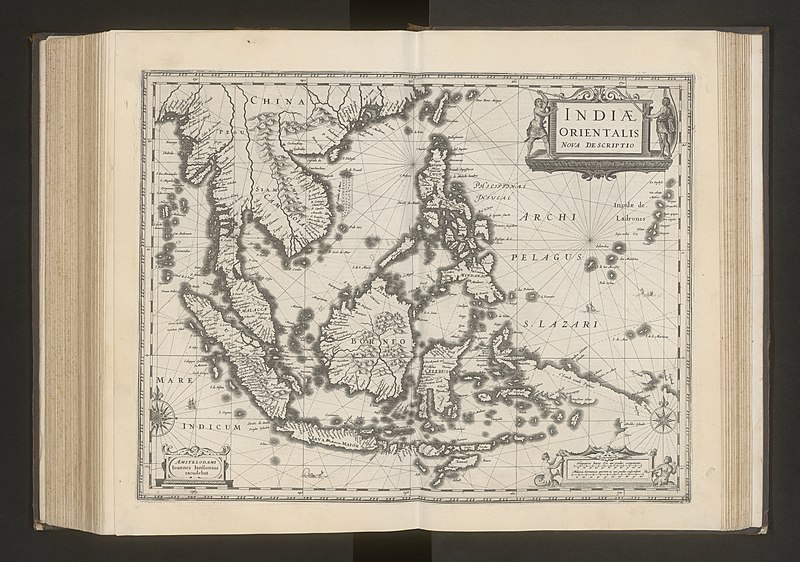
17th-century maps of southeast asia
gemeente atlas van nederland - north holland
old maps of haarlem
gemeente atlas van nederland - south holland
1860s maps of south holland
gemeente atlas van nederland - south holland
maps of zegwaart
novus atlas sinensis
maps of zhenjiang
catalan atlas, 1959 reproduction
atlas des anciens plans de paris by imprimerie nationale, 1880 from bhvp
map of paris by françois quesnel
historisk atlas (stockholm, norstedt & söner, 1880)
maps of the history of asia
coats of arms on maps
atlas novus (blaeu)
atlas van der hagen (volume 2)
atlas van der hagen
gemeente atlas van nederland - south holland
1860s maps of south holland
maps by john cary
1806 maps of asia
gemeente atlas van nederland - north holland
maps of obdam
gemeente atlas van nederland - north holland
maps of hoogwoud
gemeente atlas van nederland - north holland
maps of middelie
gemeente atlas van nederland - north holland
maps of schellinkhout
gemeente atlas van nederland - north holland
maps of spanbroek
gemeente atlas van nederland - north holland
maps of landsmeer
gemeente atlas van nederland - north holland
maps of katwoude
gemeente atlas van nederland - north holland
maps of wijdenes
gemeente atlas van nederland - north holland
maps of wormerveer
gemeente atlas van nederland - north holland
maps of oudendijk
gemeente atlas van nederland - north holland
maps of wormer
gemeente atlas van nederland - north holland
maps of oosthuizen
gemeente atlas van nederland - north holland
maps of uitgeest
gemeente atlas van nederland - north holland
old maps of heemstede, north holland
maps from university of amsterdam special collections
atlas der neederlanden
maps from university of amsterdam special collections
atlas der neederlanden
maps of barbary coast by mercator-hondius
conquest of majorca
gemeente atlas van nederland - north holland
maps of krommenie
gemeente atlas van nederland - north holland
maps of opmeer
gemeente atlas van nederland - north holland
maps of midwoud
gemeente atlas van nederland - north holland
maps of twisk
gemeente atlas van nederland - north holland
maps of avenhorn
gemeente atlas van nederland - north holland
maps of wieringerwaard
gemeente atlas van nederland - north holland
maps of wijdewormer
gemeente atlas van nederland - north holland
maps of hoogkarspel
gemeente atlas van nederland - north holland
maps of zwaag
gemeente atlas van nederland - north holland
maps of sijbekarspel
gemeente atlas van nederland - north holland
maps of urk
2701 - 2800 of 7,170
Next page
/ 72